Wednesday, August 31, 2011

Still cloudy with rain in the forecast. Watching the Gulf as a tropical wave get better organized!

All this moisture overhead is due to a tropical wave overhead. As this system moves into the gulf we have more clouds and rain in the forecast. You can expect this pattern of clouds and rain to be with us through the weekend now. This tropical wave has the potential to become our next depression or storm by Friday. It is looking like it will stay in the western gulf effecting Louisiana and Texas over the weekend. The only problem is the computer models are all over the place as this is still the beginning of a potential storm. So some changes are likely down the road. 
 
Katia is near hurricane strength and is staying out in the Atlantic.

--
Scott Zedeker
WINK TV Meteorologist

Soggy

A humid atmosphere will linger over SW Florida today and tomorrow. Expect rain at any time. - Jim

Another Cloudy & Dreary Day

SWFL got a brief break from the early morning showers today, but through the mid-day hours, we will continue to see some light rain spreading into the region. This will keep daytime temperatures well below the norm as they top out into the mid 80s. Tropical moisture will stay in place over the next couple of days with more clouds than sun and scattered rain/storms.

Tropical Storm Katia still looks fairly organized and could be upgraded to a hurricane by later today. As of 11am, winds were sustained at 65 mph on a W/NW movement at 21 mph. Some of the long range models do have Katia recurving before making it to the US mainland and possibly affecting the island of Bermuda. Still something to watch over the next few days, but no worries as we head into the Labor Day holiday weekend!

Rain, Rain Go Away

Another dreary day is underway with more clouds than sun alongside scattered showers and storms. Because of the mostly cloudy skies and wet weather, high temperatures will likely be in the 80s yet again, and even through the end of the work week, temperatures will struggle to hit 90 degrees!

Tropical Storm Katia continues to strengthen in the Atlantic. The storm has sustained winds of 65 mph, and we are expecting the storm to strengthen to hurricane strength later today. Katia, however, will not be a threat to land at least through the next 5 days.

Meanwhile, we're watching an area of disturbed weather in the northwestern Caribbean between Cuba and the Yucatan Peninsula. This tropical wave is moving WNW and has the potential to become a tropical system in the next 48 hours. If it were to become a tropical depression or storm, current models project it to directly impact Louisiana and Texas, where current drought conditions range from moderate to exceptional and a bit of rainfall will likely be welcome.

-KW

Tuesday, August 30, 2011

Another day of clouds and rain ahead! High temperture was 80 today! BRRRR!!

This extra cloudy and wet pattern is in place for the next few days. With tropical moisture to our southwest and the wind out of the southwest you can expect the moisture to hang around. On average, today we saw .25" up to an 1" across the region. Most of the rain was at our beach locations. Sanibel getting 1" to 1.66" at Ding Darling.
 
We are also watching this tropical moisture in the Gulf that could develop into a depression or storm by the end of the work week. Good news is that it will be move slowly to the west the next few days.
 
TS Katia has formed in the Atlanitc. Wind is at 60 mph and is moving to the WNW at 20 mph. Early hints say this will not bother the USA.

--
Scott Zedeker
WINK TV Meteorologist

Tropical Storm Katia Update

Tropical Storm Katia formed in the eastern Atlantic earlier this morning. As of the 11am advisory, winds are sustained at 45 mph as it moves on a W/NW track at 18 mph. Conditions are conducive for strengthening over the next couple of days, possibly into a major hurricane. This system is still thousands of miles away from the Florida peninsula, so we do have plenty of time to track Katia.

Plenty of tropical moisture continues to hang around SWFL. as a result mostly cloudy conditions will stick around through afternoon and evening with scattered rain. As a result of the cloud cover and on and off showers, daytime highs will stay well below the average into the mid 80s.

Tropical Storm Katia Forms in the Atlantic

Tropical Storm Katia was officially named at 5AM this morning. With sustained winds of 40 mph, the storm continues to move toward the west at 17 mph and is currently approx. 500 miles west of the Cape Verde Islands. Katia will not be a threat to land in the next 5 days; beyond that this storm bears watching, especially as Katia is forecast to strengthen into a hurricane in the next 48 hours.

Quite a stormy start for SW Florida. On and off storms will continue through the afternoon. Because of the stormy weather and mostly cloudy skies, highs will top out on the cool side and in the mid 80s.

-KW

Monday, August 29, 2011

Rain rain go away! Not this week!

A southwesterly wind will be with us though the week. This means we will see rain anytime during the night and daytime. As the moisture moves in from the gulf you can expect a mostly cloudy sky with temps stuck in the 80s for the next few days. It looks like we should see a few more rays of sun by the middle of the week.
 
In the tropic we are watching TD12. No threat to the US as it is roughly 3200 miles away in the middle of the Atlantic.

--
Scott Zedeker
WINK TV Meteorologist

A Rainy Week

Cloudy sky with rain this week will contrast with the fairly dry weather we had this past weekend. Abundant moisture will linger this week giving us a chance for rain at any time of day and night. - Jim

Heavy Downpours Moving in from the Gulf

Flow off the Gulf of Mexico continues to bring in plenty of moisture along with scattered showers & storms that are now lining up and down the SWFL coastline. Expect some heavy downpours along with frequent lightning throughout the mid day hours from Cape Coral to Naples with movement off to the northeast. Due to the extra cloud cover and rainfall, temperatures will vary from the upper 80s to near 90 degrees this afternoon.

Activity in the Tropics Anything But Quiet

With remnants of Irene far in Canada, our focus turns to two others tropical waves. Tropical Storm Jose formed yesterday morning near Bermuda, creating a stormy day for the little island. Jose has now pushed northward and remains a tropical storm with sustained winds of 40 mph, not impacting any land mass whatsoever. We are expecting Jose to weaken to a depression later today.

Meanwhile, a wave off the coast of Africa bears close watching. Tropical Depression 12 could very well become our next named storm, Katia, later today. The storm as of now is projected to eventually develop into a hurricane and move across the Atlantic. In the next 5 days this storm will not be a threat to any land mass, but thereafter, as it nears the Lesser Antilles, it will certainly be a topic of concern.

A stormy start to the day in SW Florida, especially in Lee and Charlotte counties. Those locations that receive ample rainfall will likely hit highs in the upper 80s. Otherwise, most of us will top out in the low-mid 90s. Keep that umbrella on hand as on and off showers and storms are forecast throughout the day.

-KW

Sunday, August 28, 2011

8AM Tropical Update: Irene and Jose

Yes, we now have a Jose. The tropical storm formed at 8AM and is expected to dissipate as fast as it formed. The storm will impact Bermuda today with 1-3" of rainfall and gusty winds. The U.S. will not be impacted by this storm. MEANWHILE, Irene made landfall as a Cat. 1 hurricane near Little Egg Inlet in New Jersey at 5:35 Sunday morning. The storm will dump 5-10" of rainfall across the Northeast with isolated areas receiving as much as 15". As of 8AM Irene maintains 75 mph sustained winds and continues to push toward the NNE at 25 mph, impacting millions. The storm is forecast to weaken to tropical storm strength later today, but keep in mind, those tropical storm force winds (<39 mph) extend 320 miles from the storm's center!

SW FL: Mind the breezy conditions heading out on the water today. We're expecting scattered storms, primarily in the afternoon with a high around 93. Same set up in store for your Monday.

-KW

Saturday, August 27, 2011

Hurricane Irene Makes Landfall Near Cape Lookout, NC

The center of Hurricane Irene made landfall around 7:30am this morning near Cape Lookout, NC. As of the 8am advisory, Irene was still packing winds of 85 mph, with higher gusts, as its bands of heavy rain spiraled across the North Carolina coast. Irene is expected to maintain Category 1 strength as it moves toward the Delmarva Peninsula, up towards NYC & Long Island, and up into the New England States by late Sunday. The Storm Surge across North Carolina is expected to be between 5' to 9'; 4' to 8' from Virginia to New England, with Hurricane force winds extending outward up to 90 miles from the center of circulation. Rainfall amounts are expected to reach between 6" and 10", with some isolated amounts of 15" when all is said and done.

As Irene moves up the Eastern seaboard, we will see some drier air sweep down the Florida peninsula on the backside of Irene, leading to a drier than average weather pattern for Saturday. A stray shower is possible throughout the afternoon hours, with highs in the low to mid 90s. A west wind off the Gulf of Mexico will continue to drive in the humidity, which will keep our heat index values near 105° and overnight lows in the upper 70s to low 80s.

Friday, August 26, 2011

Irene a little weaker but still a large cat 2 hurricane. Will make landfall in NC tomorrow morning.

THE AIRCRAFT DID NOT FIND ANY HIGHER WINDS AFTER THE RELEASE OF THE
PREVIOUS ADVISORY. IN FACT...DATA FROM NEAR THE CONCLUSION OF THE
FLIGHT SUPPORT A SLIGHT LOWER INITIAL INTENSITY. THE AIRCRAFT DID
REPORT HURRICANE-FORCE WINDS AT FLIGHT LEVEL AND SFMR WINDS OF
50-55 KT 135 N MI EAST OF THE CENTER...SHOWING THE LARGE SIZE OF
THE WIND FIELD. BUOY OBSERVATIONS AND DATA FROM AN EARLIER ASCAT
PASS SHOW THAT THE TROPICAL-STORM-FORCE WINDS EXTEND OUTWARD ABOUT
225-250 N MI OVER THE EASTERN SEMICIRCLE. RECENT MICROWAVE DATA AND
OBSERVATIONS FROM THE AIRCRAFT INDICATE THAT THE INNER CORE HAS
ERODED. ALTHOUGH IRENE WILL BE MOVING OVER WARM WATER DURING THE
NEXT 12-18 HOURS...THE LACK OF AN INNER CORE WILL LIKELY PRECLUDE
ANY RESTRENGTHENING. ALTHOUGH NOT SHOWN IN THE OFFICIAL
FORECAST...IRENE COULD WEAKEN JUST BELOW HURRICANE STRENGTH BEFORE
REACHING SOUTHERN NEW ENGLAND. HOWEVER...IMPACTS FROM THIS LARGE
TROPICAL CYCLONE WILL NOT BE VERY DIFFERENT IF IT IS A STRONG
TROPICAL STORM OR LOW-END HURRICANE. IRENE HAS THE POTENTIAL TO
PRODUCE DAMAGING WINDS...STORM SURGE FLOODING...AND EXTREMELY HEAVY
RAINS ALMOST ANYWHERE FROM EASTERN NORTH CAROLINA NORTHWARD THROUGH
NEW ENGLAND. 

IRENE IS STILL MOVING NORTHWARD OR 360/12 KT. IRENE IS EXPECTED TO
TURN NORTH-NORTHEASTWARD TONIGHT AND CONTINUE ON THAT HEADING UP
THE EAST COAST...AND BE MOVING AT ABOUT 15-17 KT AS IT APPROACHES
LONG ISLAND...MUCH SLOWER THAN NORMAL FOR STORMS IN THIS
AREA...WHICH WILL PRODUCE EXTENDED PERIODS OF TROPICAL STORM AND
HURRICANE-FORCE WINDS IN MANY AREAS. THE MODELS HAVE BEEN VERY
CONSISTENT ON THE FUTURE TRACK OF IRENE OVER THE LAST SEVERAL
CYCLES. THE NEW TRACK FORECAST IS VERY SIMILAR TO THE PREVIOUS
ADVISORY AND LIES BETWEEN THE GFS AND ECMWF.


--
Scott Zedeker
WINK TV Meteorologist
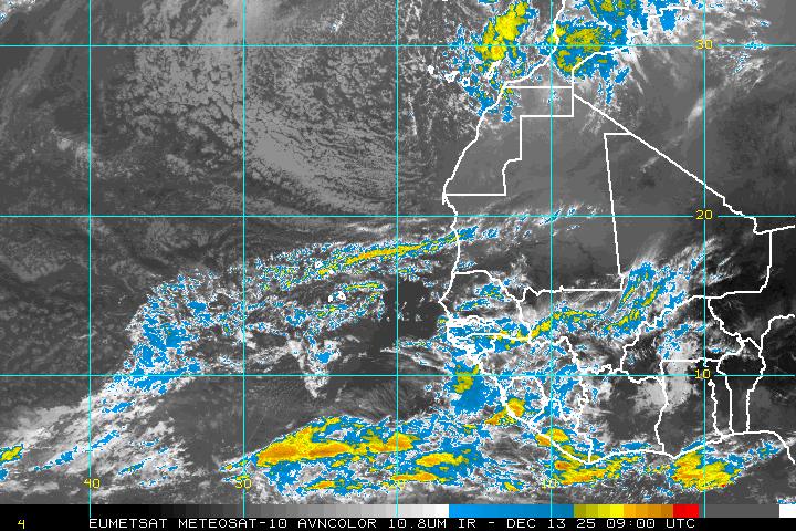
A Warm Weekend

Now that Irene has moved farther away from SW Florida we will have a fairly typical August weeekend. If anything, there might be fewer showers and thunderstorms through Monday. - Jim

IRENE Downgraded Slightly as of 5AM

Hurricane warnings extend up the eastern seaboard, as far north as New Jersey. Evacuations are underway in many coastal communities. The storm, as of 5 AM, has sustained winds of 110 mph, and has been downgraded to a Cat. 2, just 1 mph shy of being a Cat. 3. Re-strengthening later today cannot be ruled out. We are expecting Irene to make landfall as a Cat. 2/3 in the Outer Banks of NC, where we're expecting storm surge 6 to 11 feet. Irene will then move northeastward toward the DelMarVa peninsula, NJ shore, and NYC, producing dangerous storm surge, high surf, and rainfall ranging from 6-10".

-KW

Thursday, August 25, 2011

Winds Kicking Up, Thanks to Irene

Hurricane Irene is still a major category 3 storm as it continues to batter the Bahamas at this hour. Later today, Irene should start to make more of a northerly turn as it begins to approach the Outer Banks of North Carolina. Most of the models, take Irene up the eastern seaboard possibly affecting the Jersey Shore, NYC, and the Boston area early next week as a Tropical Storm. Here in SWFL, we are feeling minimal effects from Irene - Skytracker Doppler HD as of noon, has a few scattered showers with moderate rainfall across Lake O moving southwest into Immokalee. Winds are sustained out of the North & NE between 10 and 16 mph with higher gusts close to 25 mph. The breezy weather will continue into Friday with isolated showers/storms as Irene pulls away from the Florida peninsula.

OBX Prepare for the Worst

Irene remains a Cat. 3 hurricane with sustained winds of 115 mph. Tracking toward the northwest at 13 mph, the storm has the potential to further strengthen in the next 24 hours to a Cat. 4. The storm will later turn toward the north and move toward the Outer Banks of NC, which are already under evacuation. Here in FL, there is a high risk for rip currents along the Atlantic shoreline in Broward, Miami-Dade, and Palm Beach counties. Heading out on the Gulf? Expect choppy conditions with seas between 2-4 feet. The wind will begin to pick up here in SW FL later this afternoon, gusting to 25 mph. Also watch for scattered showers and storms this afternoon and evening. Breezy conditions will continue into your Friday.

-KW

Wednesday, August 24, 2011

Irene is a major hurricane heading toward the eastern seaboard. We will have a breezy day tomorrow, with a few storms.

THE SATELLITE PRESENTATION OF THE HURRICANE HAS CONTINUED TO IMPROVE
THIS AFTERNOON.  A LARGE AREA OF DEEP CONVECTION WITH VERY COLD
CLOUD TOPS HAS EXPANDED NEAR THE EYEWALL AND NOW SOLIDLY SURROUNDS
THE EYE.  BEFORE DEPARTING IRENE...THE AIR FORCE RESERVE HURRICANE
HUNTER AIRCRAFT MEASURED A PEAK 700 MB FLIGHT-LEVEL WIND OF 116 KT
IN THE NORTHEASTERN EYEWALL AND A DROPSONDE MEASURED A MINIMUM
PRESSURE OF 954 MB.  THESE DATA SUPPORT AN INITIAL INTENSITY OF
105 KT.

ENVIRONMENTAL CONDITIONS ARE EXPECTED TO REMAIN FAVORABLE FOR SOME
ADDITIONAL STRENGTHENING DURING THE NEXT DAY OR TWO. THE UW-CIMMS
OBJECTIVE SECONDARY EYEWALL FORMATION TECHNIQUE CONTINUES TO
PREDICT A HIGH CHANCE OF AN EYEWALL REPLACEMENT DURING THE NEXT DAY
OR SO. IN FACT...A RECENT TRMM MICROWAVE PASS SHOWED SOME EVIDENCE
OF A SECONDARY EYEWALL. THESE EYEWALL CYCLES CAN PRODUCE HARD TO
PREDICT FLUCTUATIONS IN INTENSITY. FOR NOW...THE NEW INTENSITY
FORECAST CALL FOR SOME ADDITIONAL STRENGTHENING FOLLOWED BY A
LEVELING OFF OF THE INTENSITY. IN 3-4 DAYS....INCREASING
SOUTHWESTERLY SHEAR AND COOLER SSTS SHOULD INDUCE GRADUAL
WEAKENING...ALTHOUGH IRENE IS EXPECTED TO REMAIN A LARGE AND
POWERFUL HURRICANE...OR EVEN GROW IN SIZE...AS IT NEARS NEW
ENGLAND.

THE HURRICANE HAS BEEN MOVING NORTHWESTWARD OR 310/10 KT. IRENE IS
EXPECTED TO TURN TOWARD THE NORTH-NORTHWEST THEN NORTH THROUGH A
BREAK IN THE SUBTROPICAL RIDGE OVER THE WESTERN ATLANTIC DURING
THE NEXT COUPLE OF DAYS.  AFTER THAT TIME...THE HURRICANE IS
FORECAST TO TURN NORTH-NORTHEASTWARD AROUND THE NORTHWESTERN SIDE
OF THE RIDGE.  BETWEEN 72 AND 96 HOURS...THERE REMAINS UNCERTAINTY
AS TO WHETHER IRENE TURNS BACK TOWARD THE NORTH AHEAD OF A
MID-LATITUDE TROUGH MOVING INTO THE GREAT LAKES REGION AT THAT
TIME.  THE NEW ECMWF SHOWS MUCH MORE AMPLIFICATION OF THE TROUGH...
WHICH HAS RESULTED IN ITS TRACK SHIFTING OVER 100 MILES TO THE
WEST...AND THIS SKILLFUL LONG-RANGE MODEL NOW DEFINES THE WESTERN
EDGE OF THE GUIDANCE ENVELOPE.  OVERALL...THE GUIDANCE ENVELOPE HAS
SHIFTED A LITTLE WESTWARD AT DAYS 4 AND 5. THE NEW TRACK FORECAST
IS CLOSE TO THE PREVIOUS ADVISORY AND IS BETWEEN THE GFS
AND ECMWF MODELS.  THIS IS ALSO CLOSE TO THE TVCA AND EXPERIMENTAL
HURRICANE FORECAST IMPROVEMENT PROJECT...HFIP...CONSENSUS TRACKS.


--
Scott Zedeker
WINK TV Meteorologist

Irene

Hurricane Irene will be due east of SW Florida late tomorrow. Actually, we will have pretty good weather although windy at times. - Jim


Hurricane Irene Maintains Category 3 Strength, with Possible Intensification

A mix of sun and clouds will take us into the rest of the afternoon hours with scattered storms and some heavier downpours making it to our coastal locations by this evening. Thursday morning will start off fairly dry as Hurricane Irene makes its presence known as it treks across the Bahamas, possibly as a category 4 storm. SWFL will see minimal impacts as Irene stays well off the Florida coastline, however you will notice an increase in the winds as they kick up to 15-20 mph, with higher gusts closer to 30 mph along with a few scattered storms. As Irene pulls away by Friday, it will remain on the breezy side, but with drier air filtering in on the backside, that will limit our storm chance all the way through the weekend.

As of 11am: Hurricane Irene is packing winds of 115 mph, making this the first major hurricane of the 2011 Atlantic season. It's movement is to the NW at 12 mph, with a minimum central pressure of 956 mb. It looks like the east coast of Florida (including Miami-Dade, Broward, and Palm Beach counties) will see more of an impact as Irene passes to the east.

Irene Now a Major Hurricane

As of 8AM Wednesday Hurricane Irene is a Category 3 storm with a sustained wind of 115 mph. This major hurricane is moving toward the west-northwest near 9 mph. A gradual turn to the northwest is forecast later today. The core of Irene will move through the Bahamas later today as well, dumping 6-12" of rainfall and producing storm surge ranging from 7-11 ft. While Florida is not forecast to take a direct hit, we in southwest Florida should expect the breeze to pick up later this afternoon and especially Thursday, but tropical storm force winds on the Gulf Coast are not expected.

-KW

Tuesday, August 23, 2011

Irene has weakened to a cat 1. We are no longer in the cone, SWFL will have minimal effects.

THE EYE OF IRENE WAS MORE APPARENT IN VISIBLE SATELLITE IMAGERY
EARLY THIS AFTERNOON...BUT HAS RECENTLY BECOME OBSCURED.  THE AIR
FORCE RESERVE HURRICANE HUNTER AIRCRAFT FOUND A MAXIMUM 700 MB
FLIGHT-LEVEL WIND OF 74 KT AND PEAK SFMR WINDS OF AROUND 75 KT. IT
HAS BEEN NEARLY 24 HOURS SINCE THE AIRCRAFT HAS MEASURED WINDS THAT
SUPPORT AN INTENSITY OF 85 KT.  THEREFORE...THE INITIAL INTENSITY
HAS BEEN REDUCED TO 80 KT.  THE PRESSURE DROPPED ABOUT A MILLIBAR
ON EACH SUCCESSIVE FIX AND WAS DOWN TO 976 MB ON THE LASS PASS
AROUND 1830 UTC.  ANOTHER HURRICANE HUNTER AIRCRAFT WILL
INVESTIGATE IRENE THIS EVENING.

THE HURRICANE WILL BE TRAVERSING VERY WARM WATERS DURING THE NEXT
COUPLE OF DAYS. HOWEVER...THE UPPER-LEVEL PATTERN IS NOT IDEAL FOR
RAPID DEVELOPMENT...AND THE GLOBAL MODELS SUGGEST MODERATE WESTERLY
SHEAR WILL CONTINUE FOR ANOTHER DAY OR TWO. THE NEW INTENSITY
FORECAST IS SLIGHTLY BELOW THE PREVIOUS ADVISORY DURING THE FIRST
24 HOURS DUE TO THE LOWER INITIAL INTENSITY. AFTER THAT...IT IS
UNCHANGED FROM THE PREVIOUS FORECAST AND BRINGS IRENE TO MAJOR
HURRICANE STATUS IN 36 HOURS. THE NEW INTENSITY FORECAST IS A BLEND
OF THE LOWER STATISTICAL GUIDANCE AND THE MORE AGGRESSIVE GFDL/HWRF
MODELS.

THE AIRCRAFT FIXES INDICATE THAT IRENE HAS BEEN MOVING
WEST-NORTHWEST OR 295/8 KT...A LITTLE SLOWER THAN BEFORE. THE TRACK
FORECAST REASONING REMAINS UNCHANGED. IRENE IS EXPECTED TO TURN
NORTHWESTWARD THEN NORTHWARD DURING THE NEXT 2-3 DAYS AS THE
WESTERN PORTION OF THE SUBTROPICAL RIDGE WEAKENS. THE TRACK
GUIDANCE IS IN REMARKABLY GOOD AGREEMENT DURING THIS TIME AND THERE
IS HIGH CONFIDENCE IN THAT PORTION OF THE FORECAST. AFTER THAT...
IRENE IS FORECAST TO MOVE NORTHWARD TO NORTHEASTWARD AROUND THE
ATLANTIC RIDGE. SEVERAL OF THE MODELS...INCLUDING THE
GFS...ECMWF...HWRF...AND GFDL...SHOW A TURN BACK TOWARD THE NORTH
NEAR THE END OF THE FORECAST PERIOD. THIS APPEARS TO BE IN RESPONSE
TO A WEAK TROUGH THAT MOVES THROUGH THE SOUTHEASTERN UNITED STATES
BEHIND THE HURRICANE. THE UPDATED TRACK FORECAST HAS BEEN SHIFTED
EASTWARD AT 72 AND 96 HOURS BUT THE NEW 5-DAY POINT IS STILL ALONG
THE LEFT SIDE OF THE GUIDANCE ENVELOPE...IN AGREEMENT WITH THE
MODELS MENTIONED ABOVE. USERS ARE REMINDED THAT LARGE FORECAST
ERRORS ARE POSSIBLE AT THE LONGER LEAD TIMES.

--
Scott Zedeker
WINK TV Meteorologist

Breezy on Thursday

Hurricane Irene should be as close to SW Florida as it will get on Thursday. I still believe SW Florida will only have gusty weather on Thursday and breezy weather on Friday, along with (of course) a few showers and thunderstorms. - Jim

Hurricane Irene Update: 11am

Good news! The entire Florida peninsula is out of the forecast cone concerning Hurricane Irene. As of the 11am advisory, Irene is still classified as Category 2 storm with winds sustained at 100 mph, with higher gusts. It's movement is still to the W/NW at 12mph, a shift to the NW is expected by Wednesday as Irene bears down on the Bahamas as a major hurricane, with a landfall by Saturday somewhere along the Carolina coastline. With Irene well to the east of SWFL, impacts should be minimal. Late Wednesday & Thursday we will see our winds pick up a bit with the possibility of a few scattered storms, with slightly drier conditions for Friday as Irene starts to pull away.

5 AM Update on Hurricane Irene


Irene is a strong Cat. 2 hurricane with a sustained wind of 100 mph, wreaking havoc on the northern coastline of Hispaniola. The storm has neither weakened nor strengthened in the last several hours, because of its interaction with the island, but the storm is forecast to strengthen in the next 24 hours to Cat. 3 strength with a sustained wind of 111 mph or greater. Much of Florida is no longer in the forecast cone; however, we will see impacts from this storm, especially on Thursday...gusty winds and stormy conditions are forecast. The wind will begin to pick up Wed PM.

-KW

Monday, August 22, 2011

Irene isn't coming here

Irene should stay over the Atlantic. It will be as close to SW Florida as it is likely to get on Thursday night. We will have a windy Thursday and a breezy Friday/ Saturday. - Jim

Watching Irene.. The track is still off the east coast of Fla. however, we are still in the cone.


DATA FROM THE LAST AIR FORCE HURRICANE HUNTER AIRCRAFT AROUND 1700
UTC INDICATE THAT THE CENTRAL PRESSURE WAS STEADY AND THE WINDS
HAVE NOT CHANGED DURING THE DAY. SINCE THEN...HIGH RESOLUTION
SATELLITE IMAGES REVEAL SOME CONVECTIVE BANDS WRAPPING AROUND A
CLUSTER OF DEEP CONVECTION NEAR THE CENTER...SUGGESTING THAT IRENE
COULD BE SLOWLY INTENSIFYING. HOWEVER...DVORAK T-NUMBERS ARE 4.0
AND 4.5 WHICH SUPPORTS KEEPING THE INITIAL INTENSITY AT 70 KNOTS.
ANOTHER PLANE WILL CHECK THE HURRICANE AROUND 0000 UTC TONIGHT.
WITH THE EXCEPTION OF THE DISRUPTION OF THE OUTER CIRCULATION BY
THE HIGH TERRAIN OF HISPANIOLA...WHICH PROBABLY WILL SLOW DOWN THE
INTENSIFICATION PROCESS DURING THE NEXT 12 TO 24 HOURS...ALL OF THE
INGREDIENTS ARE CONDUCIVE FOR IRENE TO INTENSIFY OVER THE NEXT FEW
DAYS. THE OFFICIAL FORECAST CALLS FOR IRENE TO BECOME A STRONG
CATEGORY 2 OR CATEGORY 3 HURRICANE ON THE SAFFIR-SIMPSON HURRICANE
WIND SCALE AS IRENE MOVES ACROSS THE CENTRAL AND NORTHWESTERN
BAHAMAS. IN FACT...BOTH THE GFS AND THE ECMWF GLOBAL MODELS INSIST
ON MAKING IRENE A LARGE AND STRONG HURRICANE WITH MINIMUM PRESSURES
AROUND 945 MB AND 952 MB...RESPECTIVELY. 

IRENE IS MOVING TOWARD THE WEST-NORTHWEST OR 295 DEGREES AT 11
KNOTS. CURRENTLY...THE MOTION OF THE HURRICANE IS BEING CONTROLLED
BY A NARROW SUBTROPICAL RIDGE TO ITS NORTH. HOWEVER...THE FUTURE
TRACK WILL DEPEND ON THE DEVELOPMENT OF A LARGE MID- TO UPPER-LEVEL
TROUGH ALONG THE EAST COAST OF THE UNITED STATES. THIS PATTERN WILL
INDUCE A GRADUAL NORTHWESTWARD AND THEN NORTHWARD TRACK THROUGH THE
FORECAST PERIOD WITH A SLIGHT DECREASE IN FORWARD SPEED. THERE IS
MORE CONFIDENCE IN THE FORECAST SINCE MOST OF THE TRACK MODELS...
WITH THE EXCEPTION OF THE GFDL...HAVE NOW FOLLOWED THE LEAD OF THE
ECMWF MODEL. THE GUIDANCE IS NOW IN BETTER AGREEMENT IN TURNING
IRENE NORTHWARD ALONG 78 OR 79 DEGREES LONGITUDE. ALTHOUGH IT IS
STILL TOO EARLY TO BE CERTAIN...THE GUIDANCE TREND CONTINUES TO
LESSENS THE THREAT TO SOUTH FLORIDA BUT INCREASES THE THREAT TO THE
CAROLINAS.

DO NOT TO FOCUS ON THE EXACT FORECAST TRACK...ESPECIALLY AT DAYS 4
TO 5...SINCE THE MOST RECENT 5-YEAR AVERAGE ERRORS AT THOSE FORECAST
TIMES ARE 200 AND 250 MILES...RESPECTIVELY.


--
Scott Zedeker
WINK TV Meteorologist

Irene will miss

Irene should pass far enough to the east of SW Florida so that we will not experience severe weather. Breezy conditions will be possible Thursday and Friday. Of course, we will be watching to make sure there isn't a major revision to the forecast track of Irene. - Jim

Irene Becomes the Season's 1st Hurricane

As of 7am this morning, Hurricane Irene is bringing heavy rainfall and hurricane force winds to the island of Puerto Rico. Maximum sustained winds are at 75 mph and it continues to move to the W/NW at 14 mph. The latest forecast cone from the National Hurricane Center continues to keep much of the Florida peninsula (inlcuding Southwest Florida) in it, but there has been a gradual shift to the east over the last model runs, possibly impacting the east coast of Florida, or staying just off shore as a minimal hurricane. Since the forcast track and intensity of Irene still remains uncertain, now is a good time to review your hurricane plan and check your hurricane supplies.

Sunday, August 21, 2011

Irene

While SW Florida is in the 5 day forecast cone for Tropical Storm Irene, it is too early to know the specific impacts, if any. This is a good time to review your hurricane supply checklist in case Irene is stronger and closer late this week. - Jim


Friday, August 19, 2011

Hot Weekend


Fairly typical weather is expected this weekend, hot and humid with afternoon/evening showers and storms. In the tropics: the disturbance east of the Caribbean is the one to watch. - Jim

Outdoor plans? Grab your coffee!

The best time for outdoor chores and activities will be in the morning hours, as dry conditions persist. The chance for scattered storms ramps up late this morning and continues through the afternoon and evening hours. Your Saturday and Sunday will be very similar with high temps around 93. TGIF! Have a great weekend.

-KW

Thursday, August 18, 2011

Tropical Depression 8


TD 8 has formed. It will not affect SW Florida. There are two other Tropical Waves worth watching in the Atlantic. - Jim


Mainly PM Rain


We should have fairly dry mornings followed by showers and thunderstorms in the afternoon through the weekend. I am still watching the far eastern wave in the Atlantic as "the one to watch" for now. FYI, the Gulf of Mexico has some of the warmest water on the planet at this time. - Jim

A Mainly Dry Start to the Day...

Mainly dry conditions greet those heading off to school, work or play. Watch for scattered showers and storms later this morning and afternoon. We're expecting high temperatures around 93 degrees. Friday will be similar. For your weekend, afternoon storms are in the forecast with highs around 93.

A potential tropical depression south of Jamaica will continue its movement west toward central America. When and if this storm forms, it will in no way threaten the U.S. Coastline.

-KW

Wednesday, August 17, 2011

The Not So Sunny Sunshine State

Scattered storms are yet again saying 'good morning' to southwest Florida, particularly along our coastal communities in Charlotte, Lee and Collier counties. Like yesterday, the chance for storms will remain in the forecast through the morning and afternoon hours. Afternoon highs will be suppressed in locations that receive rainfall this morning thanks to the rain-cooled air. Locations with a bit more sunshine will top out in the lower 90s. Scattered storms are forecast through the end of the work week and even into the weekend.

-KW

Tuesday, August 16, 2011

Unstable

A nearby trough of low pressure will retreat to the north the next few days. That should allow for more sun and fewer rain areas during the first half of each day. BTW, the weekend looks dry in the AM, wet in the PM. - Jim

Not an Ideal Beach Day

Showers and storms this morning west of I-75 in Charlotte, Lee and Collier counties produced a fair amount of rainfall is some gauges and is making way for cooler afternoon highs. Locations that receive and received rain today can expect highs in the 80s; those who see a bit more sun can expect temps in the lower 90s. Fort Myers Beach Golf Club by the way received more than 2". Keep that umbrella on hand, as we can't rule out a few showers and storms later this afternoon. Tomorrow, the chance for scattered storms in the morning and afternoon remains.

-KW

Monday, August 15, 2011

AM / PM Storms

A westerly flow pattern will continue into Tuesday. Expect a few isolated coastal showers/storms tonight and into early tomorrow morning with a flare up in the activity tomorrow afternoon. It will be hot with temperatures in the lower 90s with heat incdices near 100°. By late in the week high pressure will continue to build in across the peninsula, with a return to a typical summertime pattern...dry mornings with afternoon and evening storms a bit closer to the coast.
-KM

Friday, August 12, 2011

TD 6

The 6th Tropical Depression has formed. It will NOT affect SW Florida! - Jim

Thursday, August 11, 2011

More Sunshine


While we will still have a few showers and thunderstorms through the weekend, periods of sunshine will return. In the tropics: 2 Tropical Waves are in the far Eastern Atlantic, pictured on the right side of this satellite photo. - Jim

Another Wet Day on the Way

Thursday is forecast to be, yet again, on the damp and dreary side with on and off scattered storms throughout the day. Mostly cloudy skies and rain-cooled air mean cooler than average afternoon highs. For locations that receive ample sunshine in the morning, temperatures could reach the 90 degree mark; otherwise, temperatures will likely top out in the 80s.

Friday, the wet pattern will break. We're only expecting isolated coastal showers tomorrow morning; storm activity will mainly be in the afternoon, a more typical pattern for the summer months.

-KW

Wednesday, August 10, 2011

Heavy Rain


3" - 4" fell in Cape Coral / Ft. Myers on Wednesday, 1" - 3" elsewhere. Another 1" - 2" will be possible in isolated areas on Thursday before a sunnier, hotter pattern returns this weekend. There are 3 disturbances in the tropics. The two in the far Eastern Atlantic will bear watching. - Jim

Soggy

This extra soggy weather pattern will continue through tomorrow with a return to a more typical pattern by the weekend. The tropics are quiet. - Jim

Perseid Meteor Shower to Peak August 12-13

Earth is entering a stream of debris from the comet Swift-Tuttle, the source of the annual Perseid meteor shower. Specks of comet dust are hitting the top of Earth's atmosphere at 140,000 mph, creating bright bursts of light! According to the International Meteor Organization, worldwide observers now are counting more than a dozen Perseids per hour with more to come on August 12-13 (Friday and Saturday), when Earth passes near the heart of the debris stream. Friday and Saturday nights should be clearer than nights past, so head out and enjoy the show!

-KW

The Cloudy Sunshine State

Another day of more clouds than sun and scattered storms is underway. We'll start off with only isolated rumbles but see more widespread activity roll in late this morning and afternoon. Temps will top out around 90 degrees, but locations that receive ample rainfall will hit highs in the 80s. Expect a similar setup for Thursday with widespread scattered storms in both the morning and afternoon hours. Friday, the pattern will break and we're expecting mainly afternoon storms with high temps a degree warmer than average. The mercury will continue to rise through the weekend under just partly cloudy skies and afternoon scattered storms.


-KW

Tuesday, August 9, 2011

Rain, Rain Go Away

For some the rain is welcome. For others, this dreary weather is creating a slow start to the work week. Moisture over southwest Florida will continue to filter from a westerly steering wind. That means more clouds than sun and scattered showers and storms may be expected Tuesday, Wednesday and Thursday. This wetter pattern should break Friday and through the weekend, when we can expect partly cloudy skies and afternoon scattered showers and storms.

-KW

Monday, August 8, 2011

Soggy Through Thursday


A nearby trough of low pressure along with a tropical air mass will keep the chance of an anytime anywhere shower or thunderstorm. - Jim

A Stormy Start to School

Frequent lightning and heavy downpours are greeting students getting ready to head off to school this morning in Lee County. Storms, extending from Sanibel to North Ft. Myers, are moving from the west towards the east. Remember, if you can hear thunder, you are close enough to be struck by lightning. Storms, moving from the southwest heading northeast, are also rolling into Naples this morning. Scattered storms will continue through the day with more clouds than sun.

-KW

Saturday, August 6, 2011

Emily is Back...

Satellite imagery and Hurricane Hunters data confirm that Emily has re-strengthened back into a Tropical Depression albeit a weak and disorganized one. Only gradual strengthening is expected. When and if Emily strengthens to tropical storm strength (<39 mph), the storm will be well away from the Bahamas and the United States coastline, not a threat to land whatsoever. The main impact will be heavy rainfall over the northwestern Bahamas over the next 24 hours. Because of Emily, we in SW FL will have more clouds than sun and scattered showers and storms throughout Sunday.

-KW and ES

Katie Walls' Skytracker Forecast

Remnants of Emily will increase cloud cover and storm chances this afternoon and all day Sunday. The wave has a 70% chance of re-strengthening into a tropical storm in the next 48 hours. Hurricane Hunters will fly into the storm this afternoon to further investigate. When and if the storm does re-strengthen, it will NOT be a threat to the U.S. coastline and will not strengthen beyond a tropical storm.

-KW

Friday, August 5, 2011

A Hot Weekend


The remnants of Emily show no sign of reorganizing at this time (1130pm Friday). I don't expect any effect on our weather this weekend. After 96 degrees today in Ft. Myers, it will be hot this weekend with highs in the mid 90's. - Jim

Emily's Last Stand

Don't push Emily to the back of your mind just yet. The storm dissipated at 5pm Thursday, but still bears close watching. There is a decent chance, 60% actually, that the storm will re-strengthen to tropical storm strength in the next 48 hours. If the storm gets re-organized, there will be little to no threat for southwest Florida, and the storm will likely stay in the Atlantic.
That said this weekend will be rather dull thanks to this tropical wave's proximity. Watch for more clouds than sun and scattered storms Saturday and Sunday.

-KW

Thursday, August 4, 2011

Emily is no more.. however rain chances will go up Saturday and Sunday now!

Emily became a open wave as of 5 pm. This means the NHC could not find any closed circulation so thye are unable to call this a depression or even a storm. Because this is an open wave now, we can expect the movement of the moisture to be more westerly. So with that in mind, that moisture will move over SWFL Saturday and Sunday.  You can expect to see rain in the morning and in the afternoon both those days. The rest of the tropics look quiet for now.

--
Scott Zedeker
WINK TV Meteorologist

Back to PM storms

We should return to an afternoon/evening timing patteren tomorrow. Meanwhile, Emily is still on track to be drawn northward by the weekend. It still looks like Emily will have very little effect on SW Florida weather. - Jim

11am: Tropical Storm Emily Update

As of 11am, Tropical Storm Emily is on the move! Winds are sustained at 50 mph and is now moving on a W/NW track at 5 mph positioned just to the south of Haiti. As Emily crosses over some rugged terrain of Hispaniola and eastern Cuba, weakening is possible. Once it moves back over warmer waters, it is expected to reintensify as it moves closer to the Bahamas by late Friday and into early Saturday morning just off the east coast of Florida. The eastern portions of Glades and Hendry counties are right on the western fringe of the cone of uncertainty, and with the "exact" path of Emily still a bit uncertain, this system still needs to be closely monitored. Next advisory from the National Hurricane Center will be out at 2pm.
-KM

Thursday's 8 AM Update on Emily


As of 8AM Tropical Storm Emily is stationary...not at all good news for Haiti and the Dominican Republic, where we are expecting a torrential amount of rainfall in the next 24 hours. Deadly flash flooding and mudslides will be a concern. As the storm moves across mountainous Hispaniola and eastern Cuba, we are expecting the storm to weaken, but as it moves across warm Caribbean water, the storm may re-strengthen. The storm has yet to make a proper northwest turn and needs to do so soon. The farther west the storm tracks, the more of a threat it becomes to the Florida coastline.

-KW

5 AM Update on Tropical Storm Emily


Tropical Storm Emily will dump 6-12" of rainfall across Haiti and the Dominican Republic today as the storm makes landfall. Isolated areas could receive 20"+, creating deadly flash flooding and mudslides in mountainous areas. Those mountains will also help weaken the storm, but we are expecting re-strengthening over the warm Caribbean waters tomorrow and Saturday. If the storm does not begin more of a northward turn soon, the threat to Florida will increase, and a watch may need to be issued for south Florida. Next update 8AM

-KW

2 AM Update on Emily

Emily's strength has changed little in the last 24 hours. The storm has sustained winds of 50 mph and is moving west at 5 mph. The storm's lack of motion will create even heavier downpours over Haiti and the Dominican Republic: 6-12" are likely with isolated areas receiving 20"+. This will create flash flooding and mudslides across the island. Some weakening is possible in the next 24-36 hours as it interacts with Hispaniola's mountainous terrain but some re-strengthening is possible when the storm moves over the Bahamas. *If a northward motion does not begin soon, the threat to Florida will increase.* Southwest Florida remains on the outskirts of the 3 day forecast cone.

-KW

Wednesday, August 3, 2011

TC Emily is still heading west. A turn to the north is needed soon so it won impact the Florida!

The latest from the NHC. Emily needs to start turning to the north soon.. If not the cone will be adjusted to the west.
 
 
SOME DEEP CONVECTION RE-DEVELOPED NEAR THE CENTER THIS AFTERNOON...
AND DATA FROM THE AIR FORCE RECONNAISSANCE PLANE CURRENTLY IN EMILY
INDICATE THAT THE INITIAL INTENSITY REMAINS 45 KNOTS...WITH A
MINIMUM PRESSURE OF 1003 MB.  WIND SHEAR IS STILL AFFECTING THE
CYCLONE...BUT GLOBAL MODELS AS WELL AS THE SHIPS GUIDANCE INDICATE
THAT THE UPPER-LEVEL ENVIRONMENT SHOULD BECOME MORE CONDUCIVE FOR
STRENGTHENING IN ABOUT 36 HOURS. BY THEN...EMILY SHOULD BE MOVING
AWAY FROM THE INFLUENCE OF THE HIGH TERRAIN OF HISPANIOLA AND
EASTERN CUBA...AND SOME INTENSIFICATION COULD BEGIN. HOWEVER...THE
OFFICIAL FORECAST IS NOT AS AGGRESSIVE AS THE GFDL AND HWRF MODELS.

SATELLITE AND AIRCRAFT FIXES INDICATE THAT THE EXPECTED TURN TO THE
NORTHWEST HAS NOT MATERIALIZED YET...WITH EMILY STILL MOVING
WESTWARD OR 280 DEGREES AT 12 KNOTS. SO FAR MOST OF THE DYNAMICAL
MODELS...WITH THE EXCEPTION OF THE ECMWF...HAVE HAD A NORTHWARD
BIAS.  EVEN THE LATEST RUN OF THE GFS STILL REFORMS THE CYCLONE
NORTH OF THE HIGH TERRAIN OF EASTERN HISPANIOLA.  THE OFFICIAL
FORECAST HAS BEEN SHIFTED WESTWARD DURING THE FIRST 12 TO 24
HOURS...BRINGING EMILY OVER THE SOUTHWESTERN PENINSULA OF HAITI AND
THEN EASTERN CUBA.  AFTER THAT...THE OFFICIAL FORECAST STILL
ASSUMES THAT THE WESTERN ATLANTIC TROUGH WILL DEEPEN SUFFICIENTLY
TO TURN THE CYCLONE NORTHWESTWARD AND NORTHWARD. HOWEVER...IF THE
NORTHWARD TURN DOES NOT BEGIN SOON...THE THREAT TO THE SOUTHEASTERN
UNITED STATES WILL INCREASE.


--
Scott Zedeker
WINK TV Meteorologist

Emily Exposed


Emily is being affected by dry air and wind shear, clearly showing an exposed center on the visible satellite. This is not how a system strengthens! The cone is still East of SW Florida. - Jim

11am Update: Emily Shifts a Bit to the West

As of 11am this morning, Tropical Storm Emily is looking a bit disorganized as it tracks to the West at 14mph. Sustained winds are at 50 mph as it swirls just to the south of the island of Hispaniola. The latest track has Emily crossing over Haiti tonight and clipping the eastern portion of Cuba early Friday morning. As it moves over some rugged terrain, it will weaken slightly, but as it moves back out over the warmer waters it will begin to reintensify as it approaches the Bahamas on Friday. Since the latest forecast track has shifted more to the west, parts of SWFL still remain in the cone of uncertainty. So, with that being said, we still have to closely monitor the track of Emily over the next few days. Our weekend forecast all depends on the track...if Emily shifts a bit more to the east, we will actually see some slightly drier weather.
-KM

8 AM Update on Emily

Little has changed in Tropical Storm Emily since 5 PM Tuesday. As of 8 AM Wednesday, the storm has sustained winds of 50 mph and is heading westward. We are expecting the storm to move northwestward later this afternoon and evening, directly impacting Haiti and the Dominican Republic. Because of Hispaniola's mountainous terrain, Tropical Storm Emily is forecast to weaken but re-intensify as it moves over the Caribbean's warm water. The storm track continues to move east and away from the Florida coastline. Collier and Lee counties are no longer in the 5-day forecast cone, but Highlands, Glades and Hendry remain on the outskirts. The storm of course bears watching as forecasts can and do change, but as of now, the storm is not expected to directly impact Florida.

-KW

Tuesday, August 2, 2011

Emily is still a TS. But the forecast track has moved more to the east! Drier this weekend!

Emily will be steered by a large trough developing off the east coast. This should keep it our in the Atlantic off the east coast of Florida. That means drier weather for us Sunday through Monday. Stay tuned!
 
THERE HAS BEEN A SLIGHT INCREASE IN THE ORGANIZATION OF THE CLOUD
PATTERN ASSOCIATED WITH EMILY...AND SATELLITE INTENSITY ESTIMATES
REMAIN 3.0 ON THE DVORAK SCALE. THERE HAS ALSO BEEN SOME INCREASE
IN THE WINDS IN THE NORTHERN SEMICIRCLE...BUT DATA FROM THE AIR
FORCE RECONNAISSANCE PLANE INDICATE THAT THE CIRCULATION IS NOT YET
WELL DEFINED AND PRESSURES HAVE NOT FALLEN SIGNIFICANTLY SINCE
YESTERDAY.  THE INITIAL INTENSITY HAS BEEN SET AT 45 KNOTS AND
CONDITIONS APPEAR FAVORABLE FOR SLIGHT STRENGTHENING BEFORE
EMILY MOVES OVER HISPANIOLA IN ABOUT 24 TO 36 HOURS. IF EMILY
SURVIVES THE HIGH TERRAIN...THE UPPER-LEVEL ENVIRONMENT IS FORECAST
TO BE MORE CONDUCIVE FOR SOME RE-INTENSIFICATION ONCE THE CYCLONE
MOVES OVER THE SOUTHEAST OR CENTRAL BAHAMAS. THE GFS...WHICH
DISSIPATED EMILY IN THE TWO PREVIOUS RUNS HAS A SIGNIFICANT TROPICAL
STORM MOVING EASTERN HISPANIOLA AND THE BAHAMAS IN THE 12 UTC RUN.
THE ECMWF CONTINUES TO DISSIPATE THE CYCLONE.

SINCE THE CENTER HAS BEEN DIFFICULT TO LOCATE AND HAS BEEN REFORMING
DURING THE PAST SEVERAL HOURS...THE INITIAL MOTION IS HIGHLY
UNCERTAIN. IT APPEARS THAT EMILY HAS RESUMED A WESTWARD TRACK AND
IS NOW MOVING ABOUT 280 DEGREES AT 12 KNOTS.  MOST OF THE GLOBAL
MODELS CONTINUE TO SHOW THE DEVELOPMENT OF A LARGE MID-LEVEL TROUGH
OVER THE WESTERN ATLANTIC WITH THE SUBTROPICAL RIDGE SHIFTING
EASTWARD. THIS STEERING PATTERN CALLS FOR A GRADUAL TURN TO
NORTHWEST AND NORTH DURING THE NEXT SEVERAL DAYS WITH NO SIGNIFICANT
CHANGE IN SPEED. MOST OF THE LATEST TRACK GUIDANCE IS CONSISTENT
WITH THE OFFICIAL FORECAST...WHICH SHOWS EMILY MOVING NORTHWARD
ACROSS THE BAHAMAS WELL OFFSHORE OF THE UNITED STATES EAST COAST.


--
Scott Zedeker
WINK TV Meteorologist

Watching Tropical Storm Emily

We're keeping a close eye on Tropical Storm Emily as it begins its turn northwestward. Southwest Florida is in the 5 day forecast cone, and this storm bears watching. While Tropical Storm Emily is expected to strengthen, the storm is forecast to remain a tropical storm and not intesify to hurricane strength. Regardless of its exact track, we can expect increased cloudiness and showers and storms Friday, Saturday and Sunday.

For today and Wednesday watch for scattered storms, especially this afternoon with a high close to the seasonal average.


-KW

Monday, August 1, 2011

Tropical Storm Emily has formed and we are in the cone!

Even the NHC is having a hard time with the forecast.. Stay tuned for this one.. My thinking is a stronger westerly track, which could put it in the gulf..
 
DATA FROM THE AIR FORCE RESERVE HURRICANE HUNTER AIRCRAFT
INVESTIGATING THE SYSTEM OVER THE LESSER ANTILLES SHOW THAT A
WELL-DEFINED CIRCULATION CENTER HAS FINALLY FORMED NEAR THE ISLAND
OF DOMINICA...MARKING THE FORMATION OF TROPICAL STORM EMILY.  THE
INITIAL INTENSITY OF 35 KT IS BASED ON FLIGHT LEVEL WINDS OF AROUND
45 KT IN DEEP CONVECTION NORTH OF THE CENTER.  AS EVIDENCED BY THE
AMOUNT OF TIME IT TOOK THIS SYSTEM TO CONSOLIDATE AROUND A SINGLE
CENTER...THE ENVIRONMENT IS ONLY MARGINALLY FAVORABLE FOR
STRENGTHENING IN THE SHORT TERM.  THE MAIN INHIBITING FACTOR
APPEARS TO BE MID-LEVEL RELATIVE HUMIDITY VALUES OF 50 PERCENT OR
LESS AS SEEN IN THE SHIPS MODEL OUTPUT.  THE OFFICIAL FORECAST
FOLLOWS THE SHIPS MODEL THROUGH 36 HOURS...AND THEN ASSUMES THAT
EMILY WILL WEAKEN AS IT ENCOUNTERS HISPANIOLA IN 48 HOURS OR SO.
BEYOND THAT TIME...IF EMILY SURVIVES THE INTERACTION WITH THE
RUGGED TERRAIN ON THE ISLAND...GRADUAL STRENGTHENING IS SHOWN NEAR
THE END OF THE PERIOD...AND THE OFFICIAL FORECAST IS CLOSE TO THE
IVCN CONSENSUS BY DAY 5.  NEEDLESS TO SAY...THE INTENSITY FORECAST
IS OF VERY LOW CONFIDENCE GIVEN THE PRESENT ORGANIZATION OF THE
SYSTEM AND THE POTENTIAL LAND INTERACTION IN 2 OR 3 DAYS.

THE LOW-LEVEL CIRCULATION HAS BEEN MOVING QUICKLY WESTWARD...AND THE
INITIAL MOTION ESTIMATE IS A HIGHLY UNCERTAIN 275/15. EMILY IS
CURRENTLY SITUATED TO THE SOUTH OF A WEAKENING MID-LEVEL RIDGE OVER
THE SUBTROPICAL WESTERN ATLANTIC. THE GLOBAL MODELS ARE IN
GENERALLY GOOD AGREEMENT SHOWING THIS RIDGE WEAKENING OVER THE NEXT
COUPLE OF DAYS AS A MID-LEVEL TROUGH DIGS SOUTHWARD OVER THE
WESTERN ATLANTIC. THIS SHOULD ALLOW EMILY TO TURN
WEST-NORTHWESTWARD AND SLOW DOWN A LITTLE IN THE FIRST 48 HOURS.
BEYOND THAT TIME...THE TRACK FORECAST IS HIGHLY UNCERTAIN AND
DEPENDS ON WHAT SHAPE EMILY IS IN AFTER IT MOVES PAST HISPANIOLA
AND HOW MUCH THE RIDGE RE-BUILDS TO THE NORTH OF THE CYCLONE OVER
THE WESTERN ATLANTIC TOWARD THE END OF THE PERIOD. THERE IS QUITE A
BIT OF SPREAD IN THE TRACK MODEL GUIDANCE...WITH THE ECMWF TAKING A
WEAKER CYCLONE FARTHEST TO THE WEST SHOWING A TRACK NEAR SOUTHERN
FLORIDA...WHILE THE GFDL AND THE NEW 18Z GFS ARE FARTHEST TO THE
RIGHT WITH A TRACK NEAR OR EAST OF THE BAHAMAS. THE OFFICIAL
FORECAST IS A LITTLE SOUTH OF THE GUIDANCE IN THE FIRST 12 TO 24
HOURS TO ACCOUNT FOR THE MORE WESTERLY INITIAL MOTION AND LIES
CLOSE TO THE TVCA MULTI-MODEL CONSENSUS BEYOND THAT TIME. GIVEN THE
SPREAD IN THE GUIDANCE LATE IN THE PERIOD...THIS IS A GOOD TIME TO
REMIND EVERYONE THAT THE AVERAGE ERROR OF THE OFFICIAL NHC TRACK
FORECAST IS ABOUT 250 MILES AT 5 DAYS.

GIVEN THE FORECAST PARTICULARS...A VARIETY OF TROPICAL STORM WATCHES
AND WARNINGS HAVE BEEN ISSUED FOR PORTIONS OF THE LEEWARD
ISLANDS...THE U.S. VIRGIN ISLANDS...PUERTO RICO...AND HISPANIOLA.

--
Scott Zedeker
WINK TV Meteorologist

Watching the tropics

Our weather through Thusday will feature partly cloudy sky with scattered thunderstorms. Beyond Thursday, our weather will depend on the strength and track of the tropical disturbance we've been watching for over one week. Stay tuned. - Jim

Afternoon Clouds, A Few Storms

Some high cloudines this morning, is making for a beautiful & colorful sunrise. It's a warm and muggy start to the day with temperatures already approaching the 80° mark. We'll continue to see the clouds bubble up this afternoon with a few storms popping along the breeze. Hopefully, you'll be one of the lucky ones to see the rain since temperatures will be on the hot side in the low to mid 90s with heat indices in the low 100's. In the tropics we are monitoring an area of disturbed weather just east of the Lesser Antilles. The National Hurricane Center is giving this system a high chance (90%) of development, as conditions will become a bit more conducive. So, by later today, we could have our 5th Tropical Depression or Tropical Storm, which would be named Emily. The model plots this morning are in agreement, taking this system over Hispaniola and near the Bahamas by the end of the week. There's still a lot of uncertainty in the track of this system and should be watched closely over the next few days.
-KM

Blog Archive