
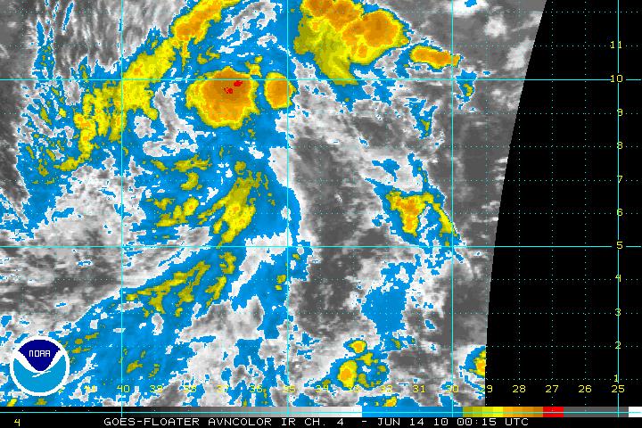
Good evening! Above, I've included two satellite images -- the first a wide view of the Atlantic basin; I'm sure the large area of clouds in the center-right of the image grabs your attention right away. The second is an infrared satellite view zoomed in on the unusually strong (for this time of year) tropical wave in the central Atlantic. Satellite data continues to indicate a developing closed circulation (one of the necessary criteria for a wave to become a tropical cyclone) -- in fact, this morning's ASCAT satellite pass did show a closed circulation with peak wind in the vicinity of 20 knots. Since this morning's pass, the system has become better organized and appears to be only hours away from becoming the 2010 Atlantic Hurricane Season's first system.
June is usually a quiet month in the tropical Atlantic, with a named storm forming -- on average -- once every couple of years. So, to get a storm in June is not totally out of the ordinary. What is, though, is where this system is forming -- in an area that is usually hostile to tropical organization until we get into the "peak months" of August and September. Usually, wind shear is strong in this area of the Atlantic this time of year and the water is not quite yet warm enough -- this time around, water temperatures are running well above average throughout the Atlantic and only get warmer/deeper as this system moves west.
Over the short term, there really is nothing that will weaken this system and everything is set for what likely will become the first named storm of the season (Alex). Between it and the Windward Islands, about 1500 miles away, wind shear is low and the water is warm. Many of our models develop this wave into a tropical storm of moderate strength. As it moves toward the Caribbean, though, wind shear is expected to be rather strong and most of the models essentially tear the wave apart over the eastern Caribbean. It's much too early to get specific here, but at this point this seems to be a reasonable forecast.
Much more coming up on the tropics and your southwest Florida forecast tonight on 6 TV at 10 and WINK at 11. Hope you can join us!
Brian